
Water Damage Assessment & Inspection in Delta
Ladner groundwater, North Delta hills, and Tsawwassen wind each get their own Delta moisture map, with readings, photos, and a category.
Ladner lots hold groundwater on flat ground near the Fraser, and the slab edge or the low drain is where it shows. North Delta, Sunshine Hills, and Annieville are the hill: window wells, uphill walls, and older laterals in basements from the 1970s and 1980s. Tsawwassen and Boundary Bay take wind off the strait at window heads, gable ends, and bluff walls. We say which community we are standing in before we write a number. Ladner, the hill, and the bluff each get their own page, because a swapped inlet wastes the whole visit. The outside photo has to match the ground you actually have. Tell us which Delta when you call.
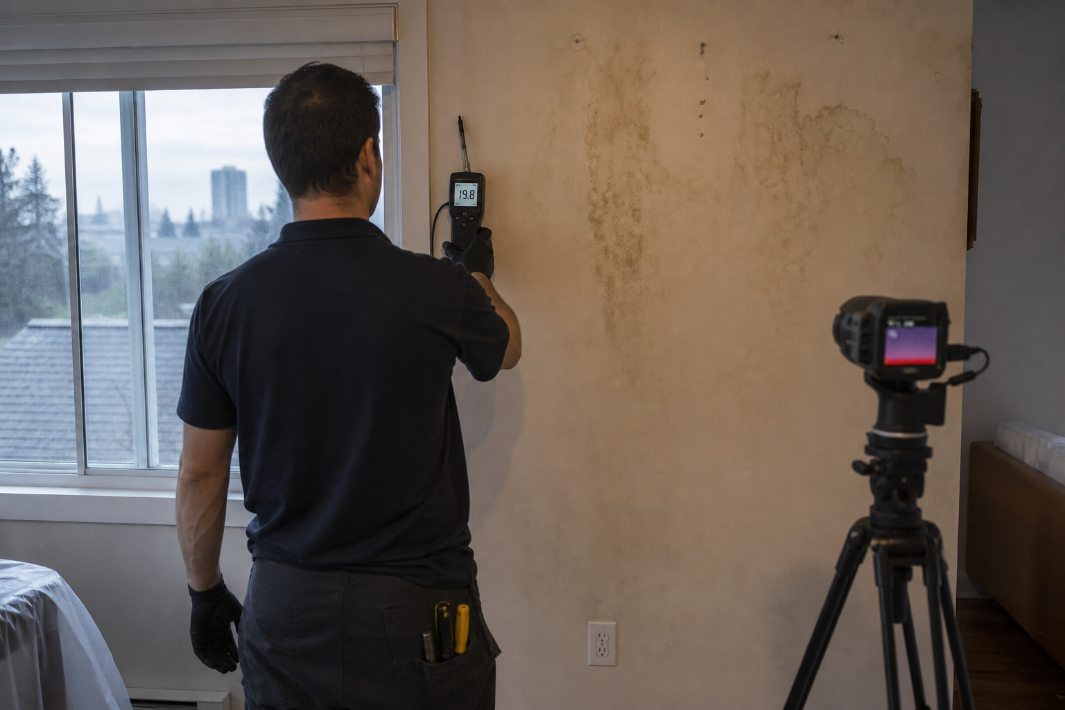
Each moisture map gets meters, photos, and a thermal camera where the cavity hides the water. The category follows that community's inlet. This is the inspection. You can forward that page as it is. It already has the photos and the pins.
Ladner flat lot moisture map where groundwater meets the slab
Ladner water shows at the slab edge, the garage, and the low drain when the ground cannot take any more. We meter the concrete from the wall inward and we photograph the grade and the ditch or the drain. Tile and vinyl hide the travel, so we read an edge or a lifted corner and we say how far we got.
The moisture map records those distances and the category. Groundwater at the footing and a dishwasher line under the floor are different inlets, and both can be true in one kitchen. Village fir upstairs gets its own scan. The page names Ladner.
North Delta hill wall moisture map below Sunshine Hills streets
Sunshine Hills and the rest of North Delta take volume down the hill. The window well and the uphill wall are the inlet we photograph first. We meter that wall in a grid and we compare it to the downhill side. Older laterals back up at the basement floor drain, so a wet drain gets its own photo and category.
The moisture map keeps surface water, the drain, and a failed sump in separate lines. A sump that quit is as common as a tired lateral on this hill. The flooring cups first beside the exterior wall, and the readings follow that direction. We write North Delta on the page.
Annieville slope footing moisture map where the hill sheds water
Annieville is on the hill with North Delta, and it still gets its own look, because the footing you have is the one we meter. Runoff arrives at the uphill wall and the well. We photograph that grade, then we pin or scan the bottom plate and the slab edge. The moisture map shows the height of the wet reading on the wall.
A lid stain in these two-storey houses is often the bath overhead or a roof valley, and that lid gets a second block with its own bay count. The footing category and the bathroom supply category stay apart, with photos for each.
Tsawwassen bluff moisture map for Boundary Bay wind driven rain
Tsawwassen and Boundary Bay take wind at window heads, gable ends, and walls on the bluff. We meter the top-floor ceiling at the outside wall and the window head, and we photograph the exposure. The thermal camera finds the wet cavity when the paint has only dulled. The moisture map is that wall and those bays.
This inlet is rain driven at the building, and the category note says so. A low village house in Tsawwassen can also leak at old flashing, which is a different bay and a different photo. We name the bluff or the village street we are on.
Questions about water damage assessment & inspection in Delta
I booked Delta. Why do you ask Ladner, North Delta, or Tsawwassen?
+
Can one report cover a Sunshine Hills well and a floor drain?
+
What does a Boundary Bay wind leak look like on the moisture map?
+
Other restoration work in Delta
Water Damage Assessment & Inspection in nearby cities
Get an Assessment
Tell us what happened in Deltaand we'll get back to you.
On this page
Water Damage Assessment & Inspection written for Delta houses, including Ladner, Tsawwassen, North Delta.
All water damage assessment & inspection details
Ready to Restore Your Property?
Burnaby's Water Damage Restoration
Specialists Are Standing By
Whether you're dealing with a flooded basement, a burst pipe, storm damage, or the aftermath of a sewage backup — our Burnaby restoration company is here to help. Call now to get an assessment and same-day emergency response.
IICRC Certified · Licensed & Insured · Serving Burnaby, BC and all of Metro Vancouver